Post amended: 18 February 2025
There is a footpath marked on Ordnance Survey, Lincolnshire County Council website and One-Network which is not sign posted, but is legally available for walking on. Therefore, can I ask the landowners to ensure access is available so that villagers can walk it when the ground dries sufficiently.
Stubton Parish Council were asked to help with ensuring the FP land owners were notified, who have since replied and said it is not their responsibility (see 16th December 2024 – Stubton Parish Council minutes). It should be noted that they are proactive when discussing these footpaths: Coach Road, Stubton to Claypole and PB8 (closed railway crossing).
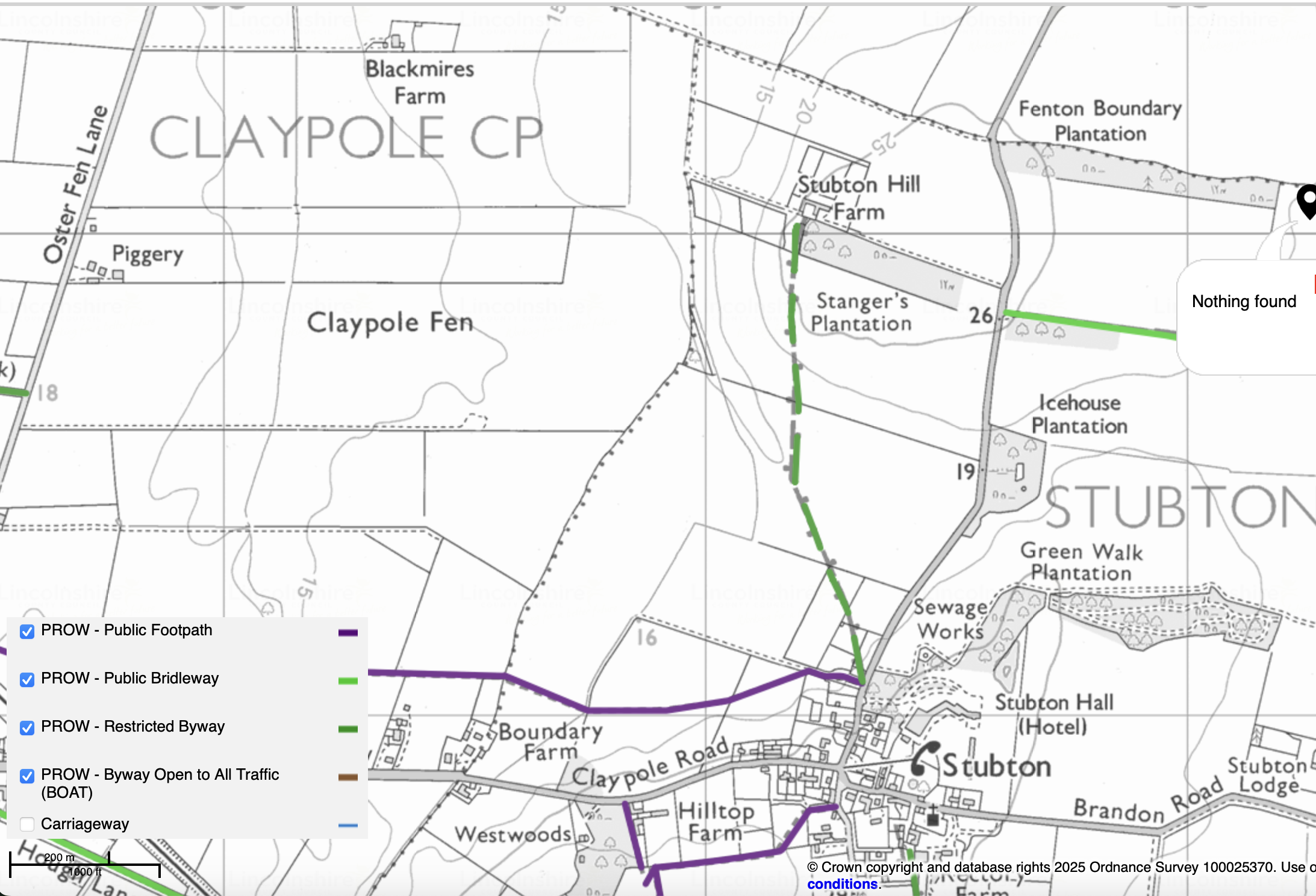
Below is a note from the senior LCC Countryside Officer when we asked about Stubton Restricted Byway No. 9.
“All known public rights of way are recorded on a legal record called the Definitive Map and Statement. I can confirm that Subton Restricted Byway No. 9 is recorded on the legal record and this provides conclusive proof of its existence. The basic highway principle of ‘Once a highway, always a highway’ applies and anybody who prevents you from using the route will potentially be committing an offence. Whilst the route isn’t physically evident on the ground, you still have a legal right to walk, ride a horse or bicycle or drive a horse drawn vehicle.
The basic highway principle of ‘Once a highway, always a highway’ applies and anybody who prevents you from using the route will potentially be committing an offence. Whilst the route isn’t physically evident on the ground, you still have a legal right to walk, ride a horse or bicycle or drive a horse drawn vehicle.”
RB 9 is a cul-de-sac route which terminates at Stubton Hill Farm” (which means you would have to turn back once reaching Stubton Hill Farm).
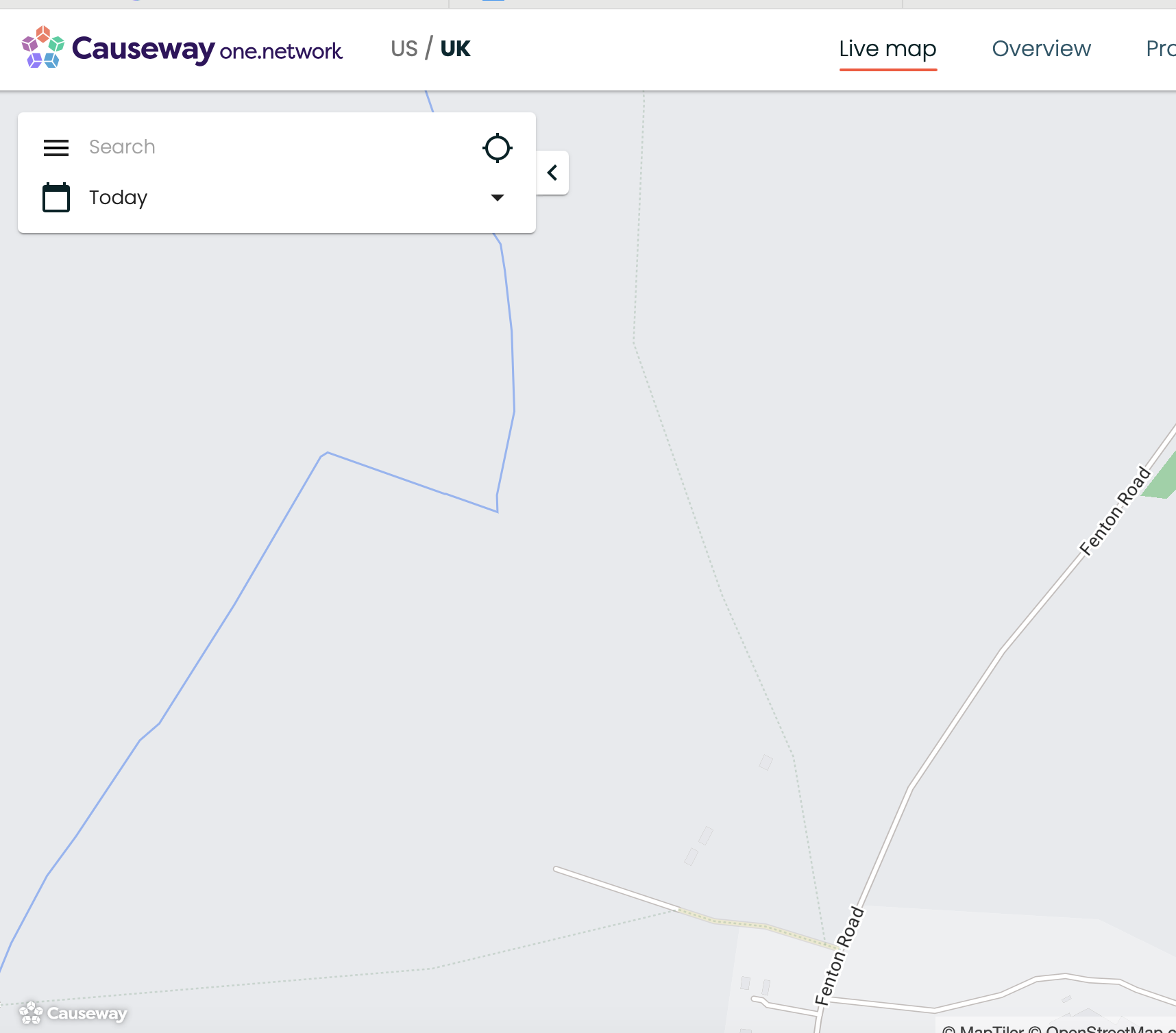
The maps below show Stubton Restricted Byway No. 9.