The name Stubton originates from Old English: Stubb ton, a farmstead where there are tree stumps. It appears in Domesday Book under the name of Stobetun/Stubetune. At that time, there were 30 households, which was then considered quite a large settlement. In 1086 the Lord and tenant-in-chief was Norman d’Arcy. Records indicate that the landscape consisted of a mix of smallholdings, plough land and meadow.
Documentary evidence of the development of the village was very sparse until the late 1700’s. The Heron family took over the Stubton Hall estate in 1789, being inherited by Sir Robert, from his uncle Sir Richard, in 1805. The house was originally used only for summer visits, but after being elected MP for Grimsby Sir Robert adopted it as his main home. Wishing initially to remodel the existing house, he commissioned Sir Jeffrey Wyatt, a sought after architect at the time, who had previously worked on Windsor Castle and the Orangery at nearby Belton House. However, when work started, on discovering the poor state of the house they revised their ideas, and a new design was prepared for a restrained, classical style building similar in style to Wolley Park in Berkshire. Sir Robert and his wife, Amelia, had no children and when he died in 1854, the estate, including large sections of land in Stubton and Claypole passed to a male relative of Amelia’s, George Neville. Beyond Stubton Hall parkland, arable farming was the main activity, providing the majority of the employment in the area.


The parish church Grade II* listed, is dedicated to St Martin and when built in 1799 consisted of a nave, pinnacled tower and vestry, located on a site commonly known as Bemrose Croft. The Bishop of Lincoln consecrated the church in June 1800. The chancel was added in1869 as a memorial to the late rector, Rev. W. S. Hampson. Although the present church is relatively modern, the Domesday Survey mentions a priest and church in 1086 and the original medieval church and churchyard occupied a site immediately opposite the present front of Stubton Hall.
The only vestiges remaining, are the two bells installed in the tower of the present church and a memorial stone dated 1530 let into the wall of the vestry.
The present church underwent considerable renovation of the tower roof and internal structures in 2010. New lighting and heating were installed in the following year. Theft of the lead from the vestry roof occurring in 2011, this was repaired and reinstated in 2013.
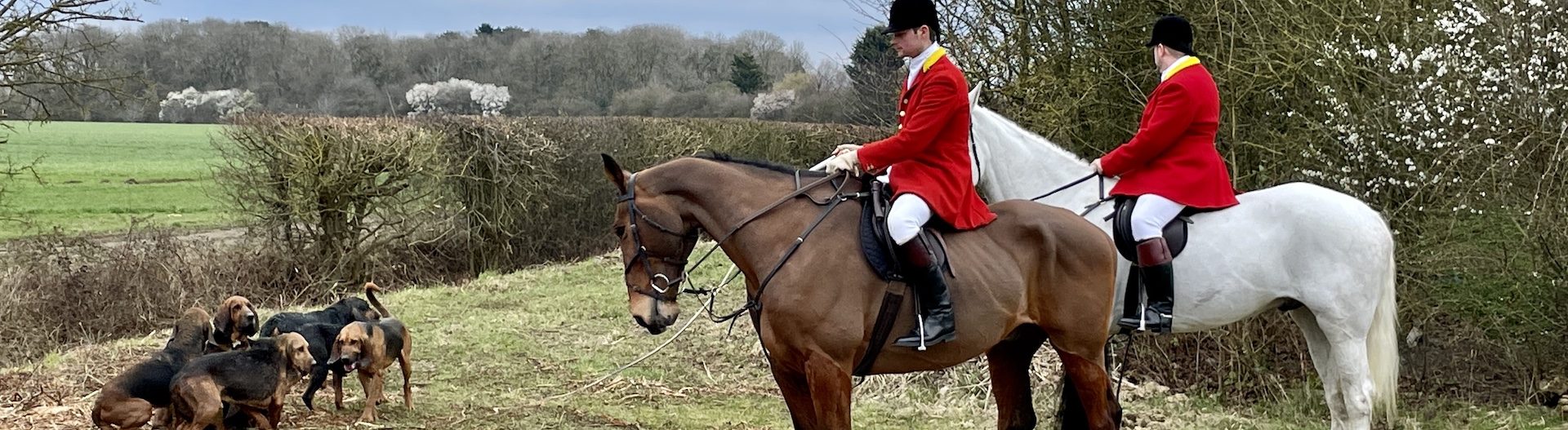
The conspicuous broken column resting upon a mound in Bemrose Croft to the northeast corner of the church, marks the grave of Sir Robert Heron. (The broken column signifies that he was last in the line). This, and a number of buildings in Stubton, is listed under the Planning Listed Buildings and Conservation Areas Act 1990 of special architectural or historic interest.
Stubton Character and Style
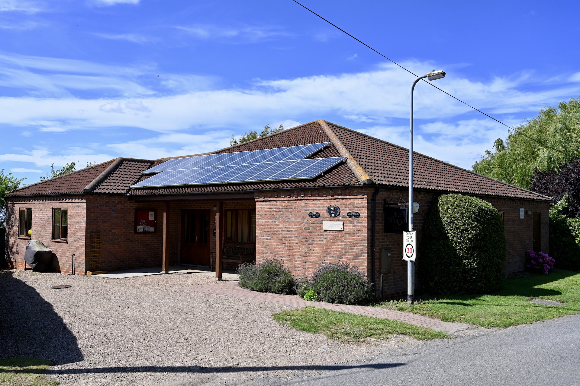
Stubton has 179 villagers, occupying 77 households. There is a very strong community ethos, with residents demonstrating a clear ‘can do’ attitude and always willing to participate in community activities. A team from the village was responsible for initiating and overseeing the construction of a new Village Hall in 2000, with considerable help from the millennium lottery fund which also made a significant contribution to major repairs to the church tower in 2010. The local community gave generously and helped with local fundraising. Other important contributors were: National Churches Trust, Marshalls Charity, Lincolnshire Old Churches Trust and Allchurches Trust. In 2011 the churchyard was cleared with volunteer help. There is always a good turnout for the frequent litter picks to keep verges and hedgerows clear. Stubton has won the Lincolnshire Best Kept Village three times, most recently in 2012. Residents’ willingness to get involved was the catalyst for the decision to start the process of creating a Neighbourhood Plan and taking ownership of the future development of the village.
Stubton forms part of the landscape character map of England defined by Natural England as: “Area 48 Trent and Belvoir Vales. A gently undulating landform, with shallow ridges dropping down gently to broad river valleys. It is an open, arable or mixed farmed landscape, strongly rural in feel, with trimmed hedges and few hedgerow trees; woodlands are only locally significant. There are frequent nucleated villages with red brick houses, roofed with pantiles, and spired churches prominent in long views.
It lies on an area of plane, with uninterrupted views east towards what is colloquially known as the “Lincolnshire cliff” at Hough-on-the-Hill. To the north the land rises gently to ‘Boundary Plantation’ to the south of Fenton. The west is a flat area of fen and pastureland stretching over the rail main line to the A1. The southern aspect again has uninterrupted views towards the Vale of Belvoir.
This small rural village consists of a single settlement which has developed in broadly linear form at the junction of four secondary roads leading from neighbouring villages. In the main, properties are set back from the roads with generous, well-tended grass verges. The village centre, defined by the pleasant open aspect of the crossroads, provides for a small village green, complete with flag pole, original red telephone box, stylish wooden bus shelter, commemorative bench and horse trough. Black metal estate fencing which delineates adjacent property boundaries, contributes to the intimate rural character of the village centre.
The built environment consists of both mixed heritage and more modern properties. A centrally located small Grade II manor house is one example of the former, built from local limestone, with steeply pitched red pantile roof. Located adjacent to Bemrose Croft on the Brandon Road is the former old school house, of single story construction with white painted brick walls and slate pitched roof. This was converted for domestic accommodation some years ago.
Within the village there are also a number of late 18th and 19th century farm houses and cottages, constructed of red brick with red clay pantile roofs. These particularly reflect the built vernacular of the local area and many of the more recently built infill properties of four bedroom detached houses have adopted these materials and style. The small, neat Grade II* listed church of St Martin Stubton is constructed of dressed limestone, with square tower and crocketted pinnacles. Its walled churchyard provides a tranquil green space at the eastern edge of Stubton.
Adjacent to the church is the Old Rectory, which, dating back to the 1850’s, is built of brick with stone quoins and a slate roof. The house sits elegantly within its parkland setting with a southerly orientation, taking in the expansive views towards the escarpment at Hough-on-the-Hill. A number of semi-detached properties within the village, previously built as staff houses have, over the years, been purchased and upgraded, whilst retaining the building style which is mainly red brick or rendered walls with tiled roofs. Off the Brandon Road, Cherry Lane consists of a small cul-de-sac development of white rendered semi-detached bungalows, built on land adjacent to the grounds of Stubton Hall.
Among the historic features in the village, there are two walls of particular interest. The first of these, being Grade II listed and constructed of local limestone capped with pantiles, is part of the Stubton Hall estate and runs along a section of Brandon Road and Cherry Lane. The second surrounds a former kitchen garden previously providing fruit and vegetables to Stubton Hall. This wall is substantially built of red brick with a wide central cavity and containing at the base, small fire grates. The warm air from the fires would circulate inside the cavities to provide heat for delicate fruits espaliered on the inner face of the wall. A large dormer bungalow built in 1972, now occupies the plot.
A small distance along the Brandon Road, is a small group of properties accessed by Gorse Lane, running through Beeswax Farm. This comprises of the farmhouse, four farm cottages, the equestrian centre and a former shooting lodge, now converted into private accommodation. The village is surrounded by farmland and there are numerous examples of original ridge and furrow fields.